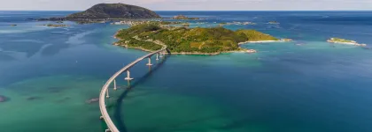
There are different ways of getting around within the Lyngenfjord region. Driving, using the buses or by bike are some examples. The most important is that you plan for your transport before arriving.
For information on how to get to the Lyngenfjord region, read more here.
By bus
There are different buses linked to different parts of our region with daily departures. Check out Svipper and their travel planner to get the right information. Usually, the bus drivers are very helpful and if you feel insecure about where you are getting off, just ask and they will help!
Many of the local buses run in correspondence with the schools.
Travelling around the region by bus requires planning, as many buses only go once a day.
By boat
The expressboat along the coast and the different ferries can take you across the fjords. The express boat connects Nord-Lenangen, Arnøya and Skjervøy. The car ferries take you across the fjords to the Lyngen peninsula, to the islands Uløya, Laukøya and Arnøya.
Find the express boat schedule and the ferry schedules at Svipper.
By bike
During the summer/autumn a biking tour is fantastic. Explore the Lyngen peninsula or go island hopping in Skjervøy. Take note that along the coast the weather can change quickly and it can get quite windy.
For mountain bikers, you can find several trails in the region to enjoy.
By car
You will soon find out that the region Lyngenfjord has many connections, winding roads, car ferries and tunnels along the way. GPS and/or a car map are very good tools for driving here. The ferry crossing Lyngseidet - Olderdalen has a fee, read about how the payments work here.
To make the most out of your holiday, our travel guide with tips on what to do, detours from the main roads and other information is a must-read.
Download the travel guide here:


